

Residential Land For Sale
$19,320
12th Ave, DeLand, FL 32724, USA
Deland, Florida, United States
0 acres
Listed By: Landcentury
Listed On: 09/13/2024
Listing ID: GL10758813
Description
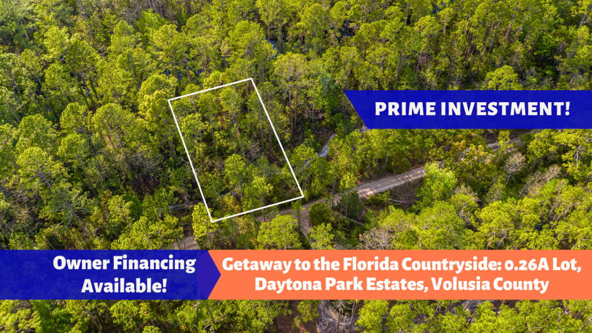
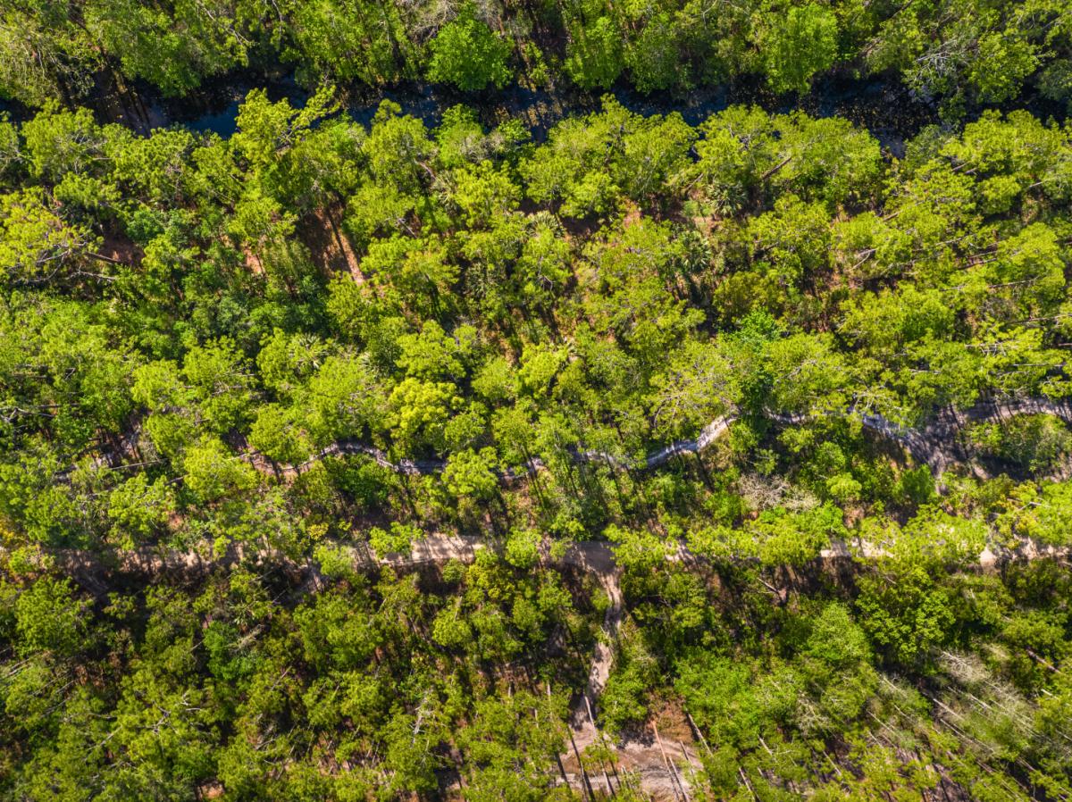
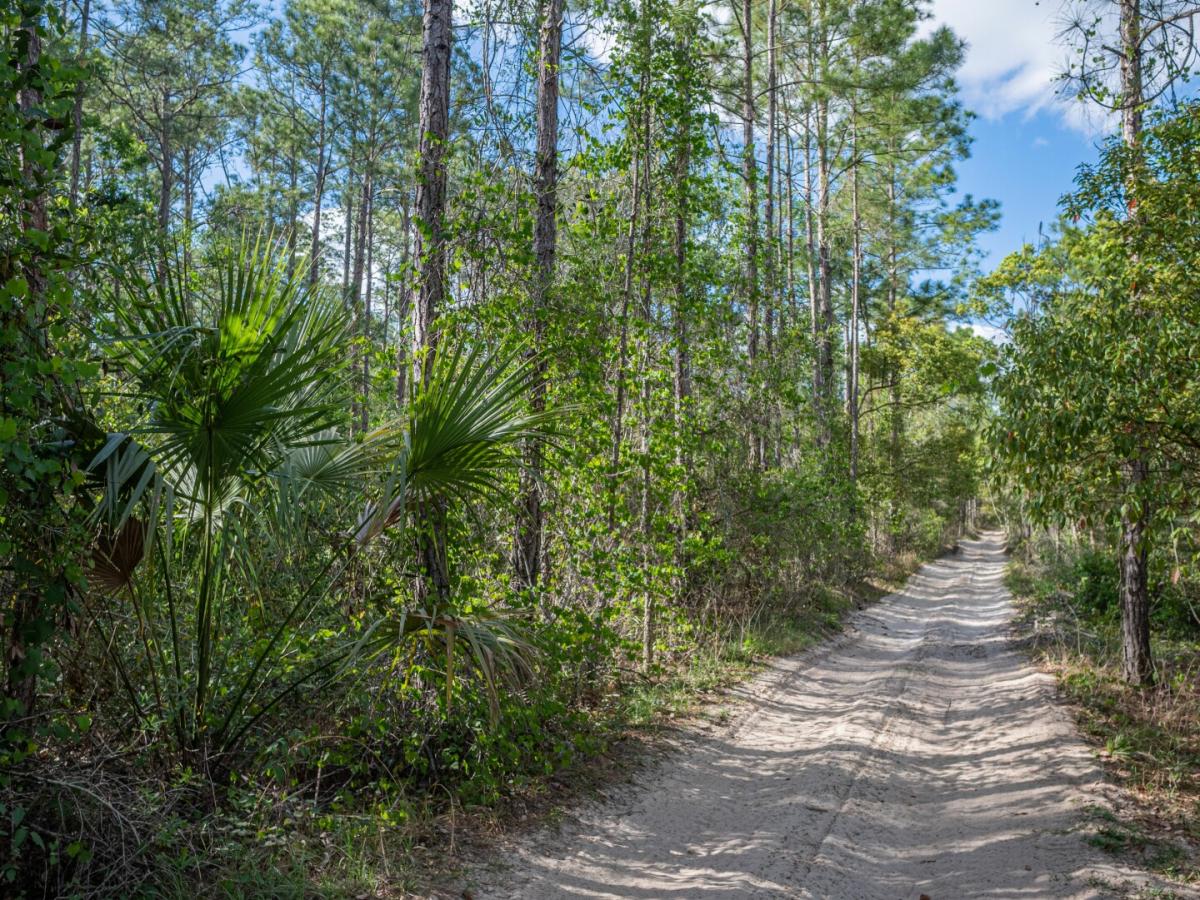
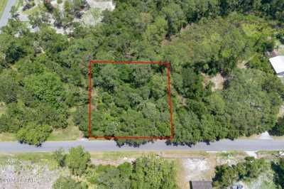
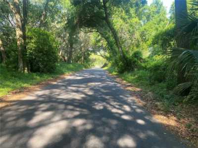
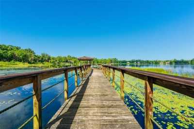
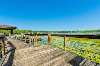
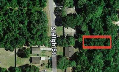
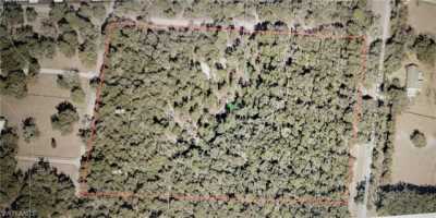
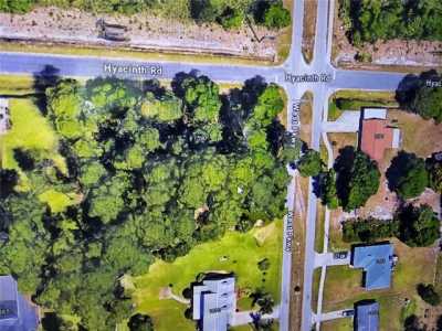
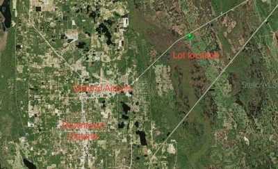
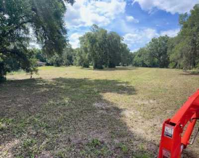
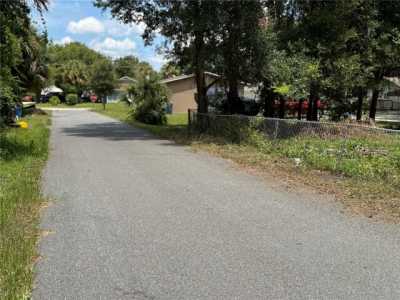
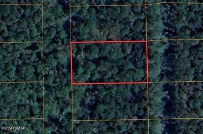
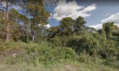
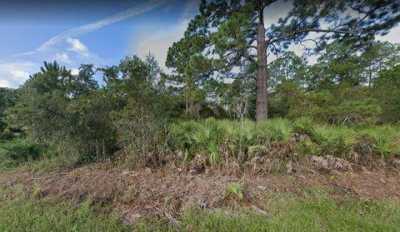
Looking for a peaceful, secluded getaway? Look no further than this 0.26-acre vacant lot in Volusia County, Florida. Nestled in Daytona Park Estates, this secluded property is surrounded by pristine forestry and scenic landscapes. At an elevation of just 47 ft., this property is perfect for singles or couples seeking serenity within the Florida countryside. Located via an unpaved road, 12th Ave. It's far enough from the hustle and bustle to provide peace and quiet, yet only a minute's drive away from either of Orlando's or Daytona Beach's City Center. Experience all the best of Florida just outside your doorstep. Hit the beach and waves, just a short drive to the world-renowned Daytona Beach. Experience the hospitality of neighboring Deland, delightfully lined with antique shops, delicious restaurants, and hear tales of the history that shaped this small-town community. The surrounding area is home to some of the best waterparks, golf courses, and tremendous wildlife, including the Shell Island Cruise and the Blue Springs State Park, host to manatees, dolphins, and prolific birdlife. With Unbelievably low Yearly Taxes, this is a low-maintenance investment for you or for your Family's generations to come. Don't miss out on this exclusive opportunity to experience the charm and warmth of the Floridian lifestyle. Invest now while it's still available! Call us to learn more. Pricing Details: Discounted Cash Price: $14,885 Property Details: Size: 0.26 acre APN: 7001-13-00-2280 State: FL City: Deland County: Volusia County Property Address: 12th AVE, DELAND, FL, 32724 General Elevation: 12.7 m or 41.8 feet GPS Center Coordinates: 29.068488, -81.243126 GPS Coordinates (4 corners): 29.068603, -81.24289 NE 29.068378, -81.242887 SE 29.068378, -81.242887 SE 29.0686, -81.243378 NW HOA: N/A Property Annual Tax: $15.51 Zoning: URBAN SINGLE FAMILY RESIDNETIAL (R-4) Terrain type: Wooded Access to property: Yes, limited dirt road access via 12th Ave Road surface/type: Dirt Building Information: What can be built on the property? Single-family standard or manufactured modular dwelling. Time limit to build? Permit will be good for 6 months. Is camping, RVs or mobile homes allowed? Not allowed UTILITIES: Power: Would have to contact Duke Energy +1 844 788 0157 Water: Would have to drill a well. Sewer/Septic: Would have to install a septic system. Nearby Cities: Closest major city: Orlando, Florida (45 min, 42.3 miles) Daytone Beach, Florida (1 hr. 36 min, 104 miles) Closest small town: North De Land, Florida (13 min, 5.1 miles) Port Orange, Florida (33 min, 23.4 miles) Nearby attractions: Earl Brown Park, 750 S Alabama Ave, DeLand, FL 32724 (20 min, 7.5 miles) De León Springs State Park, 601 Ponce Deleon Blvd, De Leon Springs, FL 32130 (25 min, 11.6 miles) Blue Spring State Park, 2100 W French Ave, Orange City, FL 32763 (26 min, 12.7 miles) Sanford Riverwalk, E Seminole Blvd, Sanford, FL 32771 (34 min, 24.3 miles) Fort Mellon Park, 600 E 1st St, Sanford, FL 32771 (37 min, 34.9 miles) Driving Directions: From Orlando: Head North on I-4 for about 36 miles. Take the exit for FL-44 W/E New York Ave in Volusia County for 2.3 miles. Turn right onto N Kepler Rd for 1.5 miles. Turn right onto Azalea Dr and then right again on Periwinkle Ave. Turn left on Nectarine road and immediately left on 1st Ave/W Lake Drive for 0.4 miles. Turn left onto West Pkwy for 0.3 miles. Turn right onto Hyacinth Rd for 0.7 miles. Turn left onto 11th Ave for 0.1 miless. Then turn right at Cypress Rd for 400 feet. Turn left on 12th ave for 0.7 miles and Property will be on the left. Use the GPS Co-ordinates to find the location. From Daytona Beach: Go southwest on US-92 W/W International Speedway Blvd for 17.4 miles. Turn left onto West Pkwy for 0.8 miles. Turn left onto Cypress Rd for 0.7 miles. Turn left on 12th ave for 0.7 miles and Property will be on the left. Use the GPS Co-ordinates to find the location. From North De Land: Head east on US-92 E/E International Speedway Blvd for 3.2 miles. Turn right onto West Pkwy for 0.8 miles. Turn left onto Cypress Rd for 0.7 miles. Turn left on 12th ave for 0.7 miles and Property will be on the left. Use the GPS Co-ordinates to find the location. From Port Orange: Head North on I-95 for 3.8 miles from Port Orange. Then turn left (Go southwest) on US-92 W/W International Speedway Blvd for 17.4 miles. Turn left onto West Pkwy for 0.8 miles. Turn left onto Cypress Rd for 0.7 miles. Turn left on 12th ave for 0.7 miles and Property will be on the left. Use the GPS Co-ordinates to find the location. Important Notes: – All of the information we have about this Property is contained on our Website Property Page. – We ask that buyers do their own Due Diligence – You can visit any of our properties at any Time. GPS Co-ordinates and Driving Directions Given – Please call the Applicable County offices for any Specific Questions about the Property Disclaimer: Buyer is responsible for verifying all information with the County as to what can and can’t be done with the land. Buyer will need to work with the County to obtain the proper permits if needed. Buyer will also need to confirm the availability of any utilities needed or serviced on the property. Seller makes no warranties or representations about the land, its condition, or what can be built on the lot parcel.Other Land Properties For Sale in Deland, Florida, United States

Advertisement

Other Properties Near Deland
- Debary Residential Land For Sale (17)
- Enterprise Residential Land For Sale (3)
- Osteen Residential Land For Sale (6)
- Sanford Residential Land For Sale (35)
- Port Orange Residential Land For Sale (25)
- Pierson Residential Land For Sale (8)
- Paisley Residential Land For Sale (22)
- Daytona Beach Residential Land For Sale (25)
- South Daytona Residential Land For Sale (4)
- Holly Hill Residential Land For Sale (1)
- Ormond Beach Residential Land For Sale (31)
- Ponce Inlet Residential Land For Sale (17)
- New Smyrna Beach Residential Land For Sale (27)
- Lake Mary Residential Land For Sale (6)
- Edgewater Residential Land For Sale (15)